Why Field Boundaries Rarely Make a Neat Pattern
Why field boundaries rarely make a neat pattern: learn to read hedges, ditches and gates as traces of practical choices and inherited land divisions.
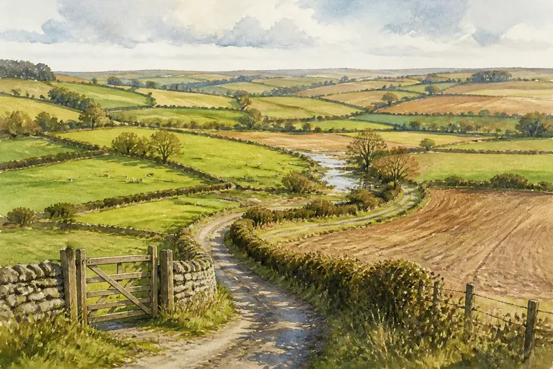
On a country lane, one hedge may run straight towards a road while another bends around a wet hollow, and a narrow strip of pasture can interrupt a broad arable field. Why field boundaries rarely make a neat pattern becomes easier to understand when you treat the landscape as a record of decisions made for different purposes at different times.
A boundary is more than a line separating two fields. It may mark ownership, keep stock in, guide water away, or preserve access to a working place. Those purposes can overlap, and they need not have begun together. The result is often less like a drawing made in one sitting than a patchwork repeatedly mended as needs changed.
Begin with a week of careful observation
A week is enough to build a useful reading habit without treating one glance as a complete explanation. Choose a familiar stretch of countryside that can be seen from a public road or path. Do not enter fields or move gates to improve your view. Keep a notebook or a simple map, and record visible features rather than guesses about who owns what.
- On the first day, mark the visible lines. Note hedges, stone walls, fences, ditches, streams, tracks and gates. Record where a line changes direction or stops.
- On the second day, look for the ground beneath it. From a lawful vantage point, note slopes, hollows, wet patches and changes in soil cover. A boundary that curves around low ground may follow drainage or avoid difficult cultivation.
- On the third day, observe how fields meet. Look for narrow strips, enclosed corners and long boundaries that continue across several parcels. Their shape may suggest different periods of division, but shape alone cannot establish when or why they were made.
- On the fourth day, note practical openings. Record gateways, breaks in hedges, culverts and places where a track meets a field edge. Their positions can indicate where stock, machinery or water need to pass.
- On the fifth day, compare the same place with another part of the route. Ask whether the boundary follows a stream, a slope, a road or a line that seems independent of the terrain.
- On the sixth day, check for changes in use. A boundary between pasture and crops may serve a different purpose from one dividing two grazing areas. Note the present use without assuming it explains the boundary’s origin.
- On the seventh day, review what remains uncertain. Separate direct observations from possible explanations. A map can show a line; it may not tell you why it was drawn.
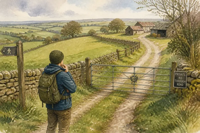
This routine gives attention to the boundary as it works now, while leaving room for older explanations that cannot be read from appearance alone. If access to a field is needed for any further inspection, seek permission rather than treating a visible gate or track as an invitation.
Different jobs leave different shapes
Some boundaries are shaped by the land itself. A stream, steep bank or marshy hollow can offer a convenient edge, though watercourses may shift and drainage can alter what counts as a wet boundary. Other lines are set out to divide an area into usable holdings. Straight runs can make parcels easier to mark or manage, while irregular edges may preserve an older route, a natural feature or a division that was never redesigned.
Boundaries also have working functions. A hedge can contain livestock and provide shelter; a ditch can carry water; a wall can separate grazing from cultivated ground. Where one feature does several jobs, its course may respond to more than a simple desire for tidy shapes. A gate placed where a track meets a field edge is a small practical adjustment to an existing line, not necessarily evidence that the whole field was planned around it.
Think of a field pattern as a patchwork coat. Each piece has an edge, but the seams may reflect repairs and additions made for different reasons. The analogy has a limit: land divisions affect access, work and ownership, so their history can carry consequences that a garment’s seams do not.
Inherited divisions can persist after their purpose changes
Once a boundary is established, later users may find it easier to keep it than to redraw it. A hedge can mature into a substantial barrier; a ditch may continue to drain a field; a wall can remain useful even when the original division of land has changed. In other cases, a boundary survives as a line on the ground after its former role has faded.
This persistence helps explain why neighbouring fields may seem mismatched. One boundary may follow a physical feature, another an inherited parcel edge, and a third a later adjustment for access or land use. The joins can be awkward because each change addressed a local need rather than redesigning the wider landscape.
Imagine you notice a narrow wedge between a straight field edge and a curving stream. You could record the wedge, the stream and the different directions of the two boundaries, then consider whether the shape helps preserve a route or reflects a division made before the current field layout. The visible result is a mapped irregularity; its cause remains a possibility to check against reliable local records, not a conclusion drawn from shape alone.
What can a field boundary tell you?
Does a straight boundary mean the land was planned at once?
Not necessarily. A straight line may reflect a deliberate division, a later adjustment or a convenient route across fairly even ground. Compare it with nearby boundaries and visible features before proposing an explanation.
Why do hedges curve around a hollow?
The curve may follow a wet area, a change in slope or an existing line of vegetation. It can also preserve an older edge, so the present shape does not identify one cause by itself.
Can an old boundary still matter if its original use has ended?
Yes. It may continue to divide fields, guide drainage or shape where people and machinery can pass. A line can remain practically useful even as the surrounding land use changes.
How can I check whether a boundary has a recorded history?
Compare suitable historic and current maps, and ask a local archive or land-history service what records are available. Maps can help show that a line changed or persisted, but they may not explain the reason; for ownership or access questions, use the relevant official records or seek qualified advice.
Use a seasonal check to separate change from inheritance
After the first week, revisit the same viewpoints at sensible points in the year. In winter, bare hedges may reveal how a line bends; during a growing season, crops or leaves can conceal smaller features. After wet weather, water may make a ditch’s role more visible, while dry conditions may make that same feature look incidental. These observations show how boundaries function under changing conditions, not necessarily how they began.
For a useful record, keep each note tied to a place and date, and mark whether it is something you saw or an interpretation. A sketch can show a gate aligned with a track; a separate note can say that the alignment might indicate a working entrance. This modest distinction prevents a plausible story from hardening into an unsupported claim.
Why field boundaries rarely make a neat pattern is not a puzzle with one answer. The lines can hold together terrain, water management, livestock needs, access and inherited divisions, all layered across a working landscape. Read them slowly, and the irregular edges become useful clues: not a complete account of the past, but a clear starting point for asking what each line does now and what evidence might explain how it came to be.